Maps
- Title : Line of Retreat of the Franklin Expedition
- Created by : Richard Julius Cyriax
- View in Gallery
- Title : Map Showing McClure’s Route Across the Northwest Passage
- Created by : unknown
- Date : 1857
- View in Gallery
- Title : Map of a Portion of the Arctic Shores of America to Accompany Captn. McClintock's Narrative
- Created by : John Arrowsmith
- Date : 1859
- View in Gallery
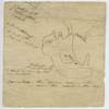
- Title : Map Drawn by Oonalee, Netsilingiut man, in 1859 showing the location where he told Captain F.L. McClintock one of Franklin's ships had sunk off Kiikertaksuak (King William Island).
- Created by : Oonalee
- Date : 1859
- View in Gallery
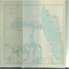
- Title : Chart of Part of the Arctic Regions as Known in 1845, Being a Copy of the Chart Supplied to the Franklin Expedition
- Created by : John Brown, adapting map from British Admiralty chart
- Date : 1860
- View in Gallery
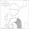
- Title : Innookpoozhejook's Sketch of King William Land
- Created by : Innookpoozhejook
- Date : 1869
- View in Gallery
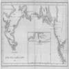
- Title : Journey to King William's Land
- Created by : Charles Francis Hall
- Date : 1879
- View in Gallery
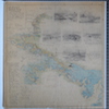
- Title : Map of King William Island with Franklin Discoveries and Sketches
- Created by : Heinrich W. Klutschak
- Date : 1880
- View in Gallery
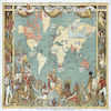
- Title : Imperial Federation, Map of the World Showing the Extent of the British Empire in 1886
- Created by : Walter Crane
- Date : 1886
- View in Gallery
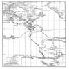
- Title : Map of the Sledge Journeys and Searches of the Franklin Search Party Under Lieut. Fred'k Schwatka, 1878-79-80
- Created by : Frederick Schwatka
- Date : 1899
- View in Gallery
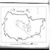
- Title : Map of King William Island by Qaqortingneq
- Created by : Qaqortingneq
- Date : ca. 1920s
- View in Gallery
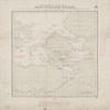
- Title : Chart Showing the Vicinity of King William Island with the Various Positions in which Relics of the Arctic Expedition Under Sir John Franklin Have Been Found
- Created by : Rupert T. Gould
- Date : 11 May 1927
- View in Gallery
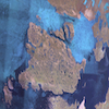
- Title : King William Island in Nunavut, Canada
- Created by : NASA (The National Aeronautics and Space Administration)
- Date : 2 September 2005
- View in Gallery
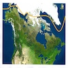
- Title : Map Showing a Route Through the Northwest Passage
- Created by : Lyle Dick
- Date : 12 April 2006
- View in Gallery
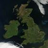
- Title : Satellite Photograph - Great Britain and Ireland
- Created by : NASA (The National Aeronautics and Space Administration)
- Date : 4 June 2012
- View in Gallery
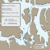
- Title : Map of Franklin Expedition in Arctic
- Created by : Parks Canada
- Date : 2018
- View in Gallery
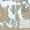
- Title : Map Showing Terror and Erebus Wreck Sites
- Created by : Parks Canada
- Date : 2018
- View in Gallery
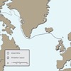
- Title : Greenhithe, England. Franklin’s expedition departed on May 19, 1845 with 134 officers and crew. During the first leg of the voyage, letters written by the men were sent home.
- Created by : Parks Canada
- Date : 2018
- View in Gallery

