Menu
Home
Contexts
Franklin's last voyage
Searching and researching
Ripples and ice jams
Interpretations
Archives
News
Introduction
Letters
Newspaper Articles
Journal Articles
Government Documents
Diaries, Journals
Books
Miscellaneous
Photos, Paintings, Drawings
Images of Artefacts
Maps
Videos
Special Collections:
Inuit Testimony
Parks Canada Collection
Expedition 2010: Mercy Bay
Expedition 2011: HMS
Investigator
Expedition 2012: Sonar Searching
Expedition 2013: More Sonar Searching
Discovery of HMS
Erebus
: 2014-15
Discovery of HMS
Terror
: 2015-16
Français
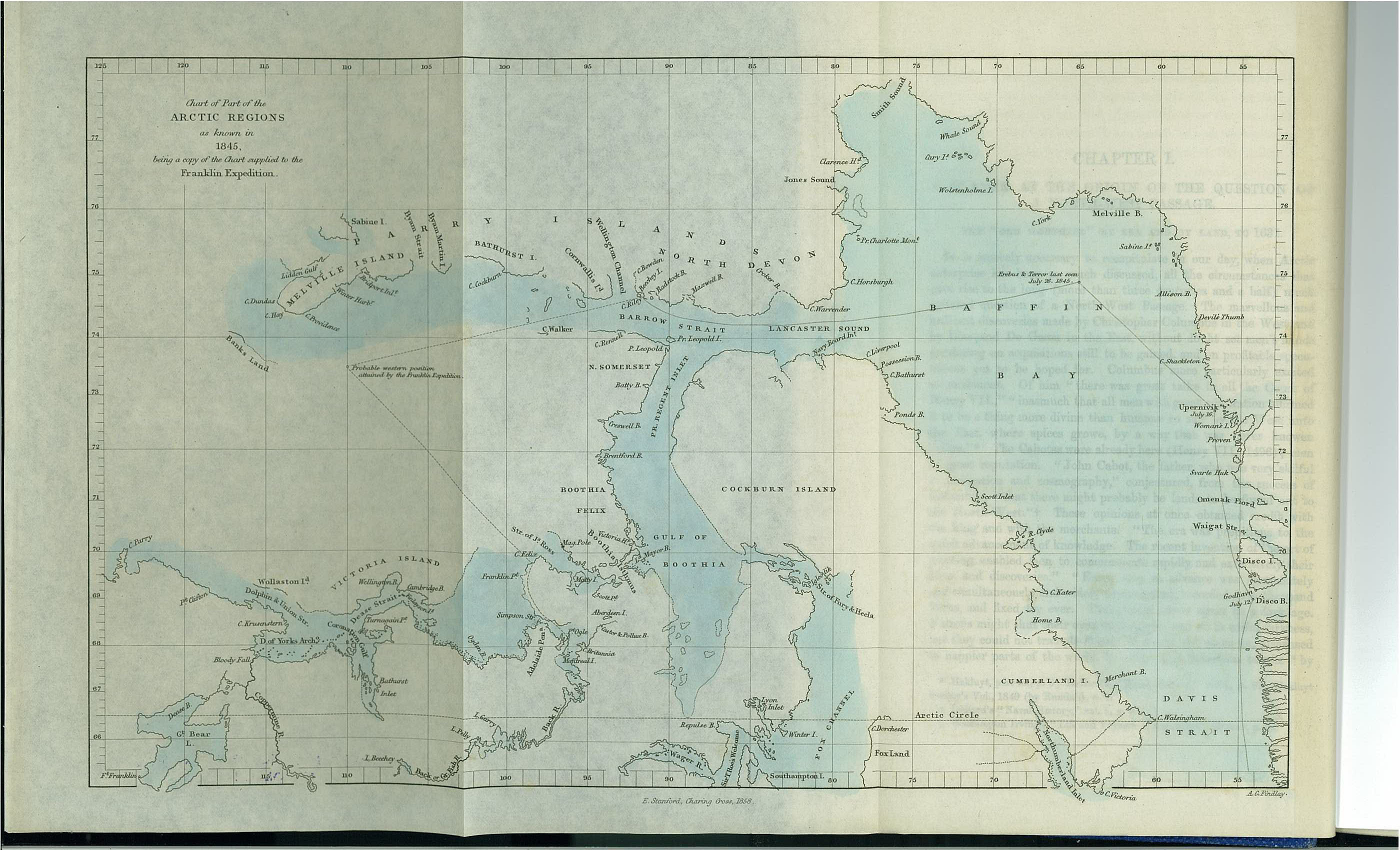
Chart of Part of the Arctic Regions as Known in 1845, Being a Copy of the Chart Supplied to the Franklin Expedition (1860)
Created by:
John Brown, adapting map from British Admiralty chart
Published by:
E. Stanford
Place:
London, U.K.
Date:
1860
Notes:
published in The North-West Passage: And the Plans for the Search for Sir John Franklin pp 4-5
About this type of source
Home
Contexts
Franklin's last voyage
Searching and researching
Ripples and ice jams
Interpretations
Archives
Becoming an Historian