| |
Maps
|
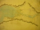
Title: Palmer Map, Bentinck Arm
Map-maker: H.S. Palmer
Archive or Repository: British Columbia Surveyor General Branch
Reference Number: Vault, Original Maps Drawer
Notes: Apparently a sketch used to prepare Lt. H.S. Palmer for his survey of the Bentinck Arm route. Made during the 1862 expedition.
Large | Larger |
|
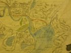
Title: Palmer Trail Detail 1
Map-maker: Lieut. H.S. Palmer
Archive or Repository: British Columbia. Surveyor Generals Branch
Reference Number: Vault, Original Maps Drawer
Notes: Apparently a sketch used to prepare Lieut. H.S. Palmer, "Sketch of the Route from North Bentinck Arm to Fort Alexandria" made during the 1862 expedition
Large | Larger |
|
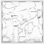
Title: Palmer Trail Detail 2
Map-maker: Lieut. H.S. Palmer
Archive or Repository: British Columbia. Surveyor Generals Branch
Reference Number: Vault, Original Maps Drawer
Notes: Apparently a sketch used to prepare Lieut. H.S. Palmer, "Sketch of the Route from North Bentinck Arm to Fort Alexandria" made during the 1862 expedition
Large | Larger |
|
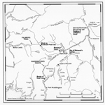
Title: Palmer, Trail 1 Slide Detail
Map-maker: Lieut. H.S. Palmer
Archive or Repository: British Columbia Surveyor General Branch
Reference Number: Vault, Original Maps Drawer
Notes: Apparently a sketch used to prepare Lieut. H.S. Palmer, "Sketch of the Route from North Bentinck Arm to Fort Alexandria", made during the 1862 expedition.
Large | Larger |
|
Title: Bentinck Arm Route
Map-maker: C. Venables
Archive or Repository: BCA
Reference Number: CM B91
Large | Larger |
|
Title: Palmer Map, Alexandria Detail
Map-maker: Lt. H.S. Palmer, drawn by J. Turnball
Archive or Repository: British Columbia Surveyor General's Branch
Reference Number: Vault, Roads and Trails Drawer
Large | Larger |
|
Title: Palmer Map, Bentinck Arm Detail
Map-maker: Lt. H.S. Palmer, drawn by J. Turnball
Archive or Repository: British Columbia Surveyor General's Branch
Reference Number: Vault, Roads and Trails Drawer
Large | Larger |
|
Title: Palmer Map, Central Detail
Map-maker: Lt. H.S. Palmer, drawn by J. Turnball
Archive or Repository: British Columbia Surveyor General's Branch
Reference Number: Vault, Roads and Trails Drawer
Large | Larger |
|
Title: Palmer Map, Deserted Shanties Detail
Map-maker: Lt. H.S. Palmer, drawn by J. Turnball
Archive or Repository: British Columbia Surveyor General's Branch
Reference Number: Vault, Roads and Trails Drawer
Large | Larger |
|
Title: Palmer Map, Elevation Slice 1
Map-maker: Lt. H.S. Palmer, drawn by J. Turnball
Archive or Repository: British Columbia Surveyor General's Branch
Reference Number: Vault, Roads and Trails Drawer
Large | Larger |
|
Title: Palmer Map, Elevation Slice 2
Map-maker: Lt. H.S. Palmer, drawn by J. Turnball
Archive or Repository: British Columbia. Surveyor Generals Branch
Reference Number: Vault, Roads and Trails Drawer
Large | Larger |
|
Title: Palmer Map, Fort Alexandria Detail
Map-maker: Lt. H.S. Palmer, drawn by J. Turnball
Archive or Repository: British Columbia Surveyor General's Branch
Reference Number: Vault, Roads and Trails Drawer
Large | Larger |
|
Title: Palmer Map, Fort Chilcotin Detail
Map-maker: Lt. H.S. Palmer, drawn by J. Turnball
Archive or Repository: British Columbia Surveyor General's Branch
Reference Number: Vault, Roads and Trails Drawer
Large | Larger |
|
Title: Palmer Map, Nimpoh Detail
Map-maker: Lt. H.S. Palmer, drawn by J. Turnball
Archive or Repository: British Columbia Surveyor General's Branch
Reference Number: Vault, Roads and Trails Drawer
Large | Larger |
|
Title: Palmer Trail Elevation
Map-maker: Lieut. H.S. Palmer, drawn by J. Turnball
Archive or Repository: British Columbia. Surveyor Generals Branch
Reference Number: Vault, Roads and Trails Drawer
Large | Larger |
|
Title: Palmer Map, Western Detail
Map-maker: Lt. H.S. Palmer, drawn by J. Turnball
Archive or Repository: British Columbia Surveyor General Branch
Reference Number: Vault, Roads and Trails Drawer
Large | Larger |
|
Title: Quesnelle Graves
Map-maker: W.S. Jemmett
Archive or Repository: British Columbia Surveyor General Branch
Reference Number: Vault, Indian Reserves Drawer
Large | Larger |
|
Title: Waddington Map, Boulder Creek Detail
Map-maker: Alfred Waddington
Archive or Repository: British Columbia Surveyor General Branch
Reference Number: Vault, Original Maps, 47 TY1
Notes: Copy of Original Map
Large | Larger |
|
Title: Waddington Map, Brewster Camp
Map-maker: Alfred Waddington
Archive or Repository: British Columbia Surveyor General Branch
Reference Number: Vault, Original Maps, 47 TY1
Notes: Copy of Original Map
Large | Larger |
|
Title: Waddington Map, Canyon, Cropped
Map-maker: Alfred Waddington
Archive or Repository: British Columbia Surveyor General Branch
Reference Number: Vault, Original Maps, 47 TY1
Notes: Copy of Original Map
Large | Larger |
|
Title: Waddington Map, Ferry Detail
Map-maker: Alfred Waddington
Archive or Repository: British Columbia Surveyor General Branch
Reference Number: Vault, Original Maps, 47 TY1
Notes: Copy of Original Map
Large | Larger |
|
Title: Waddington Map, Main Camp
Map-maker: Alfred Waddington
Archive or Repository: British Columbia Surveyor General Branch
Reference Number: Vault, Original Maps, 47 TY1
Notes: Copy of Original Map
Large | Larger |
|
Title: Waddington Map, Mt. Success Detail
Map-maker: Alfred Waddington
Archive or Repository: British Columbia Surveyor General Branch
Reference Number: Vault, Original Maps, 47 TY1
Notes: Copy of Original Map
Large | Larger |
|
Title: Waddington Map, Entire Road, Cropped
Map-maker: Alfred Waddington
Archive or Repository: British Columbia Surveyor General Branch
Reference Number: Vault, Original Maps, 47 TY1
Notes: Copy of Original Map
Large | Larger |
|
Title: Waddington Map, Slough, Camp Detail
Map-maker: Alfred Waddington
Archive or Repository: British Columbia Surveyor General Branch
Reference Number: Vault, Original Maps, 47 TY1
Notes: Copy of Original Map
Large | Larger |
|
Title: Waddington Townsite
Map-maker: P.J. Lecch
Archive or Repository: British Columbia Surveyor General Branch
Reference Number: Vault, Townsite Plans 16 T 3
Large | Larger |
|
Title: Waddington Townsite 2
Map-maker: J. Turnbull
Archive or Repository: British Columbia Surveyor General Branch
Reference Number: Vault, Townsite Plans
Large | Larger |
|
Title: Waddington Townsite 2 Detail
Map-maker: J. Turnbull
Archive or Repository: British Columbia Surveyor General Branch
Reference Number: Vault, Townsite Plans
Large | Larger |
|
Title: Bute Inlet Detail
Map-maker: Alfred Waddington
Archive or Repository: BCA
Reference Number: CM C420, Map A, Sheet 1
Large | Larger |
|
Title: Alexis Map, Brewster Massacre
Map-maker: Alexis and Ualas
Archive or Repository: Public Record Office, Great Britain
Reference Number: MPG6541
Notes: Detail from the Alexis Map showing the site of the attack on the road crew. From map originally drawn by Indians Alexis and Ualas as interpreted by Mr. Ogilvie, signed W. Cox, Benshee Lake, 22 July 1864.
Large | Larger |
|
Title: Alexis Map, Benshee Lake Campsites
Map-maker: Alexis and Ualas
Archive or Repository: Public Record Office, Great Britain
Reference Number: MPG6541
Notes: Detail from the Alexis Map showing Cox's and Brew's camp at Benshee [Puntzi] Lake. From map originally drawn by Indians Alexis and Ualas as interpreted by Mr. Ogilvie, signed W. Cox, Benshee Lake, 22 July 1864.
Large | Larger |
|
Title: Salmon Fishery of Klatsassin
Map-maker: Alexis and Ualas
Archive or Repository: Public Record Office, Great Britain
Reference Number: MPG6541
Notes: Detail from the Alexis Map showing Klatsassin's Fishery. From map originally drawn by Indians Alexis and Ualas as interpreted by Mr. Ogilvie, signed W. Cox, Benshee Lake, 22 July 1864.
Large | Larger |
|
Title: Alexis Map, Detail Showing Where McLean was Killed
Map-maker: Alexis and Ualas
Archive or Repository: Public Record Office, Great Britain
Reference Number: MPG6541
Notes: Detail from the Alexis Map showing where McLean was killed. From map originally drawn by Indians Alexis and Ualas as interpreted by Mr. Ogilvie, signed W. Cox, Benshee Lake, 22 July 1864.
Large | Larger |
|
Title: Alexis Map, Resort of Indians
Map-maker: Alexis and Ualas
Archive or Repository: Public Record Office, Great Britain
Reference Number: MPG6541
Notes: Detail from the Alexis Map showing favorite place for the Tsilhqot'in to take refuge in times of danger. From map originally drawn by Indians Alexis and Ualas as interpreted by Mr. Ogilvie, signed W. Cox, Benshee Lake, 22nd July 1864
Large | Larger |
|
Title: Chilcotin 1890 Goodland Detail
Map-maker: A.L. Pudrier
Archive or Repository: British Columbia. Surveyor Generals Branch
Large | Larger |
|
Title: Fort Alexandria Map
Map-maker: W.S. Jemmett
Archive or Repository: British Columbia. Surveyor Generals Branch
Reference Number: Vault, Indian Reserves Drawer
Large | Larger |
|
Title: Murderers Surrender, Detail
Map-maker: Alexis and Ualas
Archive or Repository: Public Record Office, Great Britain
Reference Number: MPG 654 1
Notes: Detail from the Alexis Map showing the site of the capture of Klatsassin. From map originally drawn by Indians Alexis and Ualas as interpreted by Mr. Ogilvie, Signed W. Cox, Benshee Lake.
Large | Larger |
|
Title: Tsilhqot'in Territories
Map-maker: Stuart Daniel
Editor: Cheryl Coull
Pages: 148
Large | Larger |
|
Title: Geography of the Chilcotin War
Map-maker: Stuart Daniel
Large | Larger |
|
Title: The Chilcotin War in the Larger Context
Map-maker: Stuart Daniel
Large | Larger |
|
Title: Roads to Gold
Map-maker: Stuart Daniel and John Lutz
Large | Larger |
|
Title: Geography of the Chilcotin War
Map-maker: Stuart Daniel with John Lutz
Large | Larger |
Return to parent page
|
|


